|
Yosemite
April 28 - 30, 1999
Yosemite Trip
Yosemite Valley Trail - 4/29/00
Length: 14 miles
|
|
After getting some information from the ranger at the check-in station, we
took a right to the Mariposa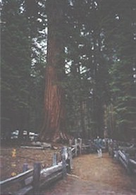 Grove. There we found some beautiful Sequoia trees.
Later we drove around Yosemite Valley taking in all of the sites that we've
only seen on TV or in magazines. We were there at last!!!! Grove. There we found some beautiful Sequoia trees.
Later we drove around Yosemite Valley taking in all of the sites that we've
only seen on TV or in magazines. We were there at last!!!!
We couldn't get lodging at Yosemite Lodge so we headed over to Curry Village and spent the
night in one of the one-room cabins. We noticed a sign in the parking lot stating that 48
cars just in the month of April had been broken into by bears. They suggest
everything with a scent; air freshners, food, etc. be removed from your vehicle.
Yosemite was not at all as I had imagined it to be. Knowing how many
visitors enter the park each year, I imagined this big commercial touristy
experience. It was NOT like that at all (at least not in April when we were
there)...it was so much more - breathtaking! Lodging is limited and is very
rustic in the valley...as it should be.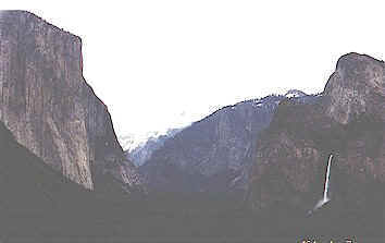
The
cabin had two beds, a desk and a heater which was fine except for the
"unwelcome" residents of the cabin. We were close to the restroom/shower house
so that made it nice in the middle of the night.
Although, when I awoke at 3am to make that trip, I came back to find a bed full of
bugs!!!!!! I lifted my pillow and voila...that's when I found the residents of the
cabin!!! Ahhh!!!
I
took the bedding off of the bed, sat in the middle of the bed on the sheet with the light
on all night waiting for the little critters to appear so I could kill them! I know it was
a rustic experience but I think at this point I'd rather be in my tent. We booked the
cabin
 for 2 nights but decided to find another place for the 2nd night. The
second day we made plans to hike 14 miles of Yosemite Valley which would bring us up close
and personal to the Falls and some very nice Kodak moments! for 2 nights but decided to find another place for the 2nd night. The
second day we made plans to hike 14 miles of Yosemite Valley which would bring us up close
and personal to the Falls and some very nice Kodak moments!
We frequently paused along the trail at the base of some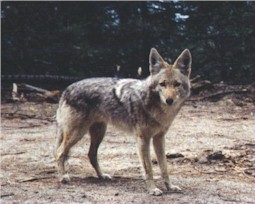 vertical slabs so Dave could do some rock climbing. Saw quite a few
deer grazing in fields. They didn't seem to be afraid of the many
people and cars around them. We headed out of the Valley
around 5pm and decided to look for a hotel about 2 hours south where we
could get a nice shower and rest up before we continued on the next day with
the last leg of the trip back to Sue's house.
vertical slabs so Dave could do some rock climbing. Saw quite a few
deer grazing in fields. They didn't seem to be afraid of the many
people and cars around them. We headed out of the Valley
around 5pm and decided to look for a hotel about 2 hours south where we
could get a nice shower and rest up before we continued on the next day with
the last leg of the trip back to Sue's house. |
|
|
April 24 - 27, 2000
Mist Trail/John Muir Trail - 4/25/00
Length: 7 miles |
|
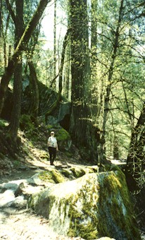
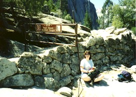 The
Mist Trail leaves from Roads End. The trailhead is at the east end of the parking
lot. It crosses Copper Creek across level terrain. The trail then winds its
way up the ledge of the mountain. At 2 miles we reached a junction near the foot of
Bailey Bridge. The
Mist Trail leaves from Roads End. The trailhead is at the east end of the parking
lot. It crosses Copper Creek across level terrain. The trail then winds its
way up the ledge of the mountain. At 2 miles we reached a junction near the foot of
Bailey Bridge.
Past the bridge we took a right onto the John Muir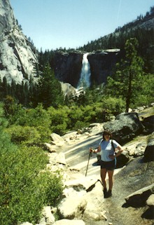 Trail.
After the 7th switchback you get a spectacular view of Yosemite Valley and
Upper Yosemite Fall.
Then the back side of Half Dome comes into view. The 9th Trail.
After the 7th switchback you get a spectacular view of Yosemite Valley and
Upper Yosemite Fall.
Then the back side of Half Dome comes into view. The 9th
 switchback
skirts the base of Panorama Cliff. At the 17th switchback the trail
levels off reaching Clark Point. Here the trail splits. switchback
skirts the base of Panorama Cliff. At the 17th switchback the trail
levels off reaching Clark Point. Here the trail splits.
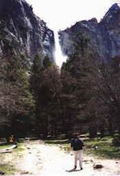
Due
to bad conditions, the trail was closed going to Nevada Fall so we had to leave the John
Muir Trail at this point and take the .6 mile path to the top of Vernal Fall back on to
the Mist Trail.
At this point Dave ventured off to the top of Nevada Falls. At Vernal Fall
we took a break on the rocks to enjoy the beauty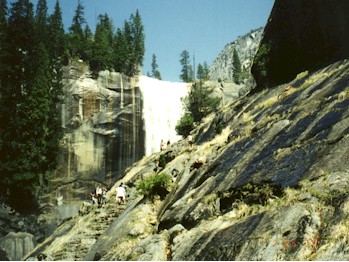 of our surroundings.
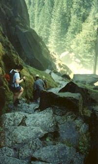
The walk
down was a cautious one.
of our surroundings.
The walk
down was a cautious one.
The trail is a steep
vertical descent on a staircase of rocks which
are slippery from the
mist of the falls. You have a continuous view of the fall and the
white mist rising from below it.
The trail continued on
and we eventually met back up with the Mist Trail and back to the foot
bridge. We retraced our steps back to
the trailhead. |
|
April 24 - 27, 2000
Tenaya Canyon Trail - 4/26/00
Length: 4.8 miles |
 The trail begins at
Tenaya Bridge. In a short distance, the trail forks so take the left branch along
the south bank of Tenaya Creek. At this point we noticed a sign stating "bridge
out ahead" so we figured we'd go as far as we could and double back. At .8 mile,
we reached the edge of a marshy area that was at one time, Mirror Lake. The trail begins at
Tenaya Bridge. In a short distance, the trail forks so take the left branch along
the south bank of Tenaya Creek. At this point we noticed a sign stating "bridge
out ahead" so we figured we'd go as far as we could and double back. At .8 mile,
we reached the edge of a marshy area that was at one time, Mirror Lake.
Continuing on a mostly level path, you reach what used to be a bridge crossing
Tenaya Creek at 2.1 miles. Because of high waters at one time, the bridge was washed
out and hasn't yet been replaced. It looks like a big job to replace the bridge over
the swift moving water. At this point we had no choice but to turn around and head
back the way we came.
All along the trail it was evident that extensive trail work had been done to
repair other damage that the high waters had caused. |
|
|
April 24 - 27, 2000
Sequoia National
Forest - 4/27/00 |
|
|
|
|
|
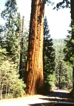
One of the many giant
sequoias in the park. |
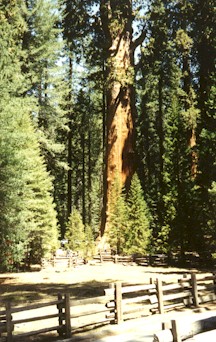
This sequoia is in a fenced in area
and lays claim to being the oldest
living "thing" in the world. |
|
|
 |
|
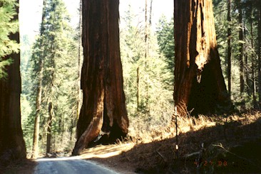
Giant sequoias near the road's
edge. |